26 November 2019
|
Explore the environment where your Bedfordshire ancestors lived with new colour tithe maps, just released by TheGenealogist.
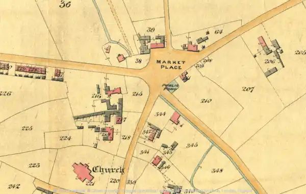
The colour tithe maps for Bedfordshire to join the previously published greyscale maps in their National Tithe Records collection. The maps allow you to explore the exact plot that a Bedfordshire farmed or occupied.
The release of colour digitised maps provides anyone searching for Bedfordshire ancestors with highly detailed plans sourced from The National Archives (TNA). TheGenealogist has linked these to the appropriate apportionment books that provide researchers with the details of the plots, their owners and their occupiers at the time that the survey was taken in Victorian times.
These make the maps easier to understand as features such as streams, rivers, lakes, ponds, houses and trees are often highlighted in different colours.
Identifying Bedfordshire ancestors
The tithe maps are not just restricted to those who owned large-scale estates - the survey also identifies occupiers of smaller plots and those who occupied 'ordinary' houses and cottages. For more on the maps, click here.
QUICK LINK: Expert video - how to use Master Search on TheGenealogist
Subscribers to TheGenealogist’s Diamond membership can now select to view the latest colour or grayscale maps when using the Tithe & Landowner records for this county of England.


