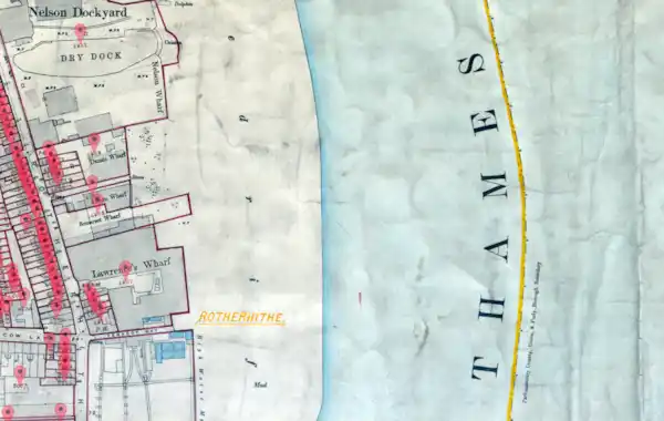
The Southwark home of actor Michael Caine's is among the thousands of properties included in the latest Lloyd George Domesday Survey Property release from TheGenealogist.
These property records are a great resource for researchers searching for where an ancestor lived in the period 1910-1915 and the latest release brings the number of named individuals in the Lloyd George Domesday Survey Property records to 800,000.
The Lloyd George Domesday Survey is a massive project being carried out by TheGenealogist to digitise a combination of large scale Ordnance Survey maps and residential data field books from The National Archives. Using the records from the former Valuation Office Survey (known as the Lloyd George Domesday Survey) enables family history researchers to precisely pinpoint where an ancestor’s house had been on exceptionally detailed hand annotated maps from the period. These have been georeferenced and are displayed as a layer in TheGenealogist’s Map Explorer™.
What records are included?
This new release of records include properties situated in the following Southwark parishes: Bermondsey Central, Bermondsey East, Bermondsey South, Bermondsey West, Camberwell, Camden, Christchurch, Dulwich, Dulwich East, Peckham North, Peckham South & Nunhead, Rotherhithe, Rye Lane & St Georges, Saint Peter, St George the Martyr East, St George the Martyr North, St George the Martyr South, St Georges East, St John by Horsleydown, St Mary & St Paul, St Olave & St Thomas, St Saviour 1, St Saviour 2, and Trinity.
Read TheGenealogist’s article about how the Lloyd George Domesday Survey Property records from the 1910s show us the Southwark home of Michael Caine’s family at TheGenealogist website.


