13 April 2012
|
In case you missed our April issue, we thought it would be a good idea to post here our news story revealing a fantastic new webs
In case you missed our April issue, we thought it would be a good idea to post here our news story revealing a fantastic new website www.oldmapsonline.org. Read on for the full story...
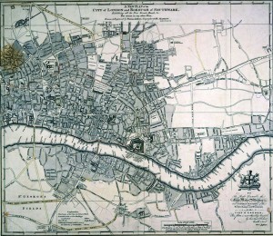
The broadest single collection of historical maps from around the world has been made available online for free at www.oldmapsonline.org. The site, described by its creators as ‘like Google for old maps’, will act as a central repository to a vast collection of historical maps held by institutions across the globe. It is the first time that access to such an extensive collection has been made available online.

The service, hosted by the University of Portsmouth, launched with a collection of more than 60,000 maps, which will double by the end of the year. The site incorporates access to maps from some of the most diverse collections in the world including collections from the British Library, the National Library of Scotland, the Moravian Library in the Czech Republic and the prestigious David Rumsey Collection in California.
The project, worth £180,000, has been funded by the Joint Information Systems Committee (JISC).
Project director, the university’s Dr Humphrey Southall, said that the site offers easy access and search facilities to maps that were already online but almost impossible to find, providing insight into the way the world used to look.
The project intends to recruit more collections from libraries worldwide, building up the site’s resources in order to become the largest collection of its kind.


